Support the Timberjay by making a donation.

Input sought on route for North Country Trail
REGIONAL— Most Americans have heard of the Appalachian Trail or the Pacific Coast Trail. These national scenic trails have existed for decades and have been used by millions of Americans over …
This item is available in full to subscribers.
Attention subscribers
To continue reading, you will need to either log in to your subscriber account, or purchase a new subscription.
If you are a current print subscriber, you can set up a free website account and connect your subscription to it by clicking here.
If you are a digital subscriber with an active, online-only subscription then you already have an account here. Just reset your password if you've not yet logged in to your account on this new site.
Otherwise, click here to view your options for subscribing.
Please log in to continue |
Input sought on route for North Country Trail
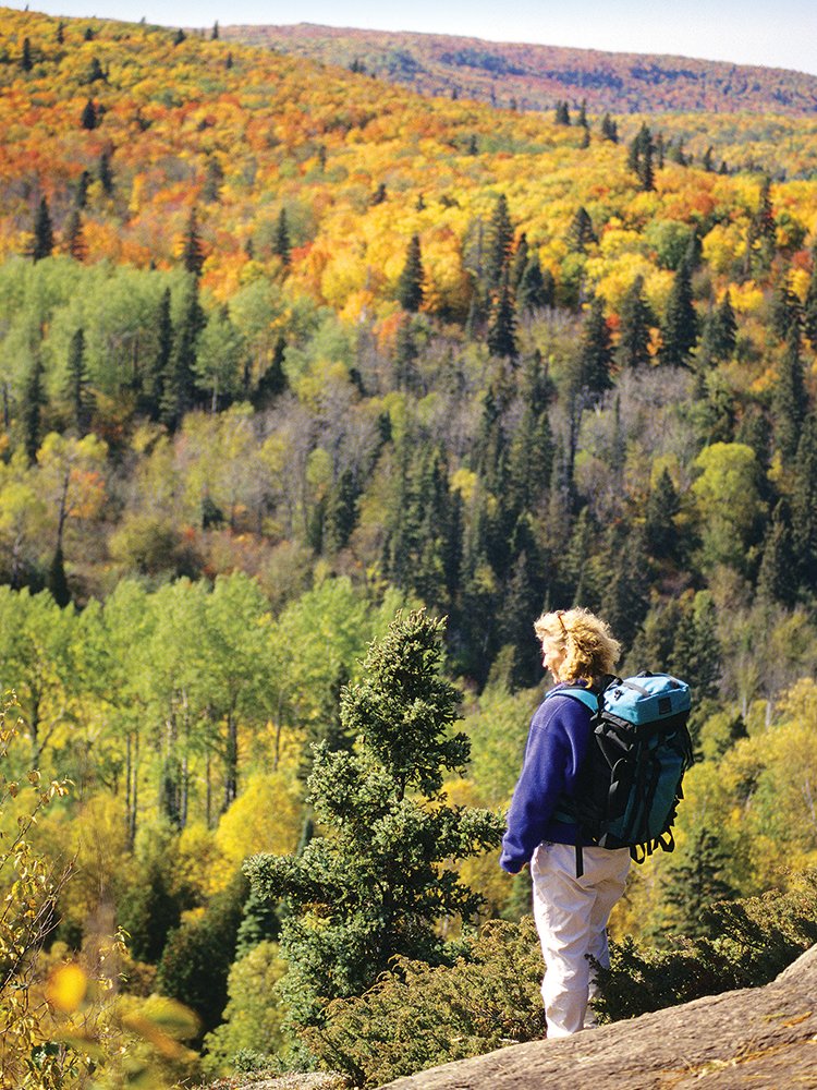


REGIONAL— Most Americans have heard of the Appalachian Trail or the Pacific Coast Trail. These national scenic trails have existed for decades and have been used by millions of Americans over the years.
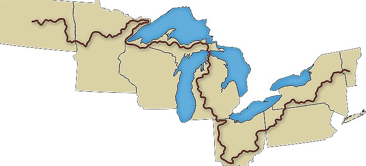
The North Country Trail, or NCT, was officially designated by Congress in 1980 and has been under development ever since. Once completed, it will stretch from Vermont to western North Dakota, making it the longest of all the national trails at approximately 3,300 miles. Most of the trail is already in place, although the route through portions of northeastern Minnesota is still uncertain. It was originally slated to head west from near Duluth across the state to North Dakota. Last year, however, Congress approved the “Minnesota Re-Route,” which extends the trail up the North Shore of Lake Superior to Grand Portage before heading back to the west.
Fine-tuning that route, particularly in the Ely-to-Tower corridor is the goal of a planning effort currently underway. “We don’t know exactly where the trail is going to go,” said Josh Bergstad, senior planner with the Arrowhead Regional Development Commission, or ARDC, which is assisting with the planning effort. The NCT makes use of the Superior Hiking Trail, extending along the North Shore. From there, it heads west through the Boundary Waters, first utilizing the Border Route Trail before connecting to the Kekekabic Trail and eventually arriving in Ely. From there, the route is less certain.
“We do know that Tower will be right in the middle of the planned corridor,” said Bergstad.
While the Mesabi Trail will soon connect Tower and Ely, Bergstad notes that the NCT is designed to be an unpaved backcountry trail, not a paved bike path. For now, the Mesabi Trail is a designated route but trail officials are asking the public for ideas as they plan development of the final backcountry route. “We’re just asking people to give us as many ideas as possible,” said Bergstad.
The ARDC recently sponsored an online public workshop to solicit ideas but turnout was somewhat limited, so they’re reaching out in other ways to spread the word. “There will be more meetings throughout the process,” said Bergstad. “We’re hoping to get more participation.”
Trail officials are looking for routes as well as points of interest along the way. Scenic locations or interesting side trails are all popular with NCT hikers and are called “positive control points” by trail planners. They’re also interested in negative control points, which would be places that the trail should avoid, either because they’re open to motorized use, or are industrial or blighted. According to Bergstad, local residents are often the most familiar with such points of interest, which is why they’re trying to get the word out. “When we get these ideas from the public, ARDC will compile them into an online GIS system. Then North Country Trail staff will go out in the field and try to connect them.”
The ARDC has an interactive online tool that they’re encouraging the public to use to suggest either positive or negative control points. You’ll find that online tool at bit.ly/NCTPlanning.
Once a route is identified, the trail itself will be modest, with a standard four-foot wide cleared corridor. Because the trail is primitive, the costs associated with its construction are minimal, with most of the work for construction and maintenance undertaken by volunteers.
For more information, you can email or call Josh Bergstad with comments and questions or to discuss alternate methods to submit information. You’ll find him at jbergstad@ardc.org or at 218-529-7516.
You can also visit the project website to view updates, trail documents, and access the mapping tool at www.ardcplanning.org/nct.
Or you can like their Facebook page at facebook.com/northcountrytrail for notification of updates on the project.


