Support the Timberjay by making a donation.
Spring fire season may linger well into June
REGIONAL— A June fire season? In Minnesota? While June is typically down time for firefighters in northern Minnesota, that may not be the case this year with temperatures running well above …
This item is available in full to subscribers.
Attention subscribers
To continue reading, you will need to either log in to your subscriber account, or purchase a new subscription.
If you are a current print subscriber, you can set up a free website account and connect your subscription to it by clicking here.
If you are a digital subscriber with an active, online-only subscription then you already have an account here. Just reset your password if you've not yet logged in to your account on this new site.
Otherwise, click here to view your options for subscribing.
Please log in to continue |
Spring fire season may linger well into June
REGIONAL— A June fire season? In Minnesota?
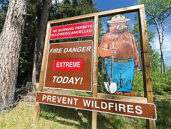
While June is typically down time for firefighters in northern Minnesota, that may not be the case this year with temperatures running well above normal the past couple weeks and in the extended forecast, and precipitation running well below average.
In a typical late May and June, frequent rainfall and the spring green-up usually puts an end to fire danger, at least temporarily. Memorial Day weekend in the North Country traditionally comes with showers and high temperatures in the 60s. That wasn’t the case this past holiday weekend, however, as the area experienced high temperatures in the 80s, with low humidity, wind, and no rainfall. That prompted red flag warnings at least two of three days last weekend, an unusual circumstance for what is traditionally considered the start of summer in Minnesota.
“It feels like it just snuck up on us,” said Leane Langeberg, public information officer with the Minnesota Interagency Fire Center in Grand Rapids. “We really haven’t received much precipitation since the snow melted.”
While this week brought scattered showers and some heavier thunderstorms across parts of the region, it wasn’t enough to end the continuing danger of wildfires in the region. “The danger will continue until we get some significant measurable rainfall,” said Langeberg. At this point, fire conditions will vary day-to-day, said Langeberg, depending on precipitation, relative humidity, and wind. Humidity is especially key. “When humidity drops below 25 percent, fires can move quickly,” she said.
The conditions are becoming reminiscent of 2021, when fires burned tens of thousands of acres in the region during an extended drought. Langeberg said the area began the season this year with more soil moisture than during 2021, which is helping for now. The area isn’t currently in drought even though rainfall is running considerably below average. Most reporting stations in northern St. Louis County are reporting barely an inch of precipitation in May, or about a third of normal for the month. Extended outlooks for the first half of June show a continuing trend of above normal temperatures and below normal precipitation.
Dropping river levels
The building precipitation deficit is being seen in plummeting river levels in parts of the region. The flow of the Little Fork River is highly dependent on recent precipitation and its level has dropped remarkably since the flooding experienced in late April and early May. As of Monday, the river’s flow had fallen from 2,070 cubic feet per second (cfs) to just 655 cfs, which puts the river in the low-flow category. Other area rivers have seen less dramatic declines in water levels but all are trending downward. It remains to be seen if that trend is reversed by heavy rain that hit parts of the area during thunderstorms Tuesday night. That rain has at least temporarily eased fire conditions as well.


