Support the Timberjay by making a donation.

The “Big Gulp” gets green light
Hi-Lo forest treatment project to impact 17,000 acres along Echo Trail corridor
REGIONAL—A forest treatment plan that encompasses more than 17,000 acres in and around the Echo Trail north of Ely has gotten the green light from the Superior National Forest supervisor. It’s …
This item is available in full to subscribers.
Attention subscribers
To continue reading, you will need to either log in to your subscriber account, or purchase a new subscription.
If you are a current print subscriber, you can set up a free website account and connect your subscription to it by clicking here.
If you are a digital subscriber with an active, online-only subscription then you already have an account here. Just reset your password if you've not yet logged in to your account on this new site.
Otherwise, click here to view your options for subscribing.
Please log in to continue |
The “Big Gulp” gets green light
Hi-Lo forest treatment project to impact 17,000 acres along Echo Trail corridor
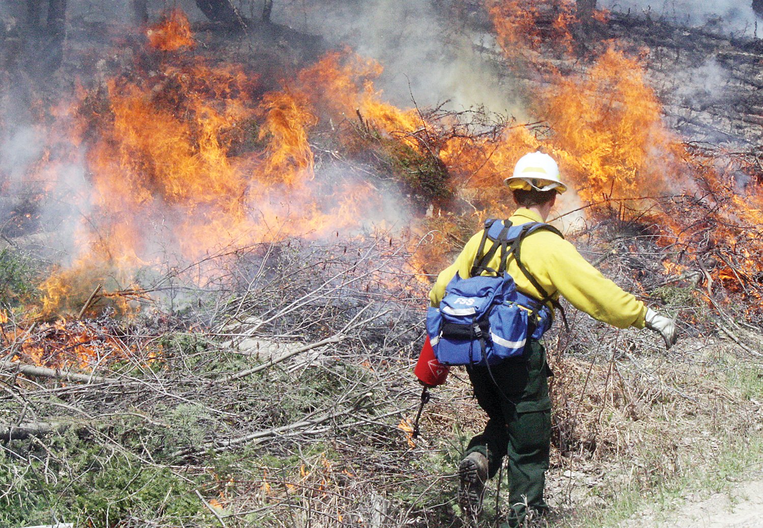
REGIONAL—A forest treatment plan that encompasses more than 17,000 acres in and around the Echo Trail north of Ely has gotten the green light from the Superior National Forest supervisor. It’s known as the Hi-Lo project and it is certain to have a noticeable impact on a large swath of recreational territory just north of Ely, including much of the north shore of Burntside Lake as well as more than a dozen other lakes to the north and east of Burntside. Those include High, Dry, Low, Bass, Everett, Fenske, Nels, Grassy, Ed Shave, and Big lakes.
In the Record of Decision signed on March 11, forest supervisor Connie Cummins stated that the project is intended to improve wildlife habitat, provide timber resources to industry, enhance recreational opportunities, and reduce fire danger to properties located along the edges of the Boundary Waters Canoe Area Wilderness.
Of the 17,700 acres scheduled for treatment, a total of 5,575 acres will be subject to various types of commercial timber harvest, ranging from clearcutting to thinning.
The vast majority of the treatment will be completed through prescribed burning, encompassing a total of 11,532 acres.
Kawishiwi District Ranger Gus Smith said while the project has generated some controversy over the four years it’s been under development, it’s consistent with the Forest Service’s ongoing efforts to protect resources in a heavily-used portion of the Superior from the potentially catastrophic effects of a major wildfire.
“That area is probably our most attractive recreational part of the district,” he said. “The Bass Lake trails, the North Arm, Burntside Lake in general, is all prime recreational area.” And interspersed among the federal lands at issue are numerous cabins and lake homes, as well as resorts and camps, including both Widjiwagan and Camp du Nord operated by the YMCA.
Significant blowdown events, most recently in 2016, which flatted about 66,000 acres of forest within the Kawishiwi District, have built up forest fuels that Forest Service officials fear could spark a devastating fire. And thousands of acres of dead and dying balsam fir and spruce, killed in recent years by spruce budworm, have only added to the fire danger.
Smith, whose professional background is in fire ecology, notes that fire has a useful role to play in forest management as long as it is used frequently enough to limit the buildup of ladder fuels that can quickly convert an otherwise low-intensity underburn into a catastrophic crown fire.
By reducing forest fuels along the perimeter of the Boundary Waters, particularly in areas most likely to be downwind of a fire within the wilderness, Smith said it allows the Forest Service to let fire play more of its natural role within the wilderness boundaries. “The idea was to come up with a strategy that hardens the boundary and reduces the risk of fire escaping the Boundary Waters,” he said.
The Forest Service took initial steps in that direction a few years ago using a combination of mechanical treatment and prescribed fire between the wilderness boundary and the North Arm Road. Smith said he expects that fire crews will be back in that same area, possibly as early as this spring, to continue that work.
Smith acknowledges that the scale of the Hi-Lo project constitutes what he calls “a big gulp,” but he said it’s a project that will likely take at least five years to complete and will involve plenty of meetings with affected parties and property owners as the work progresses.
Despite the scale of the project, it generated relatively few objections from the public. The environmental group Wilderness Watch did object to a plan to use prescribed fire on 1,341 acres of forest within the BWCAW boundaries. But Smith said it was an effort to balance possible harms, noting that the impact to the affected portion of the Boundary Waters could be significantly greater if a severe fire broke out.
The plan’s extensive use of prescribed fire does pose some risks, as the Forest Service demonstrated in 2016 when the planned Foss Lake burn escaped the prescribed perimeter and became a wildfire that burned 1,015 acres near the western tip of Burntside Lake.
In that instance, the wind direction pushed the fire into the Boundary Waters, which spared valuable lakeshore property on Burntside Lake.
While prescribed fire does come with risks, it also has noticeable benefits for wildlife, particularly moose, which are strongly attracted to areas regenerating from recent fire.
Impact to roadless areas
Some also questioned the Hi-Lo project’s plan to use some commercial logging in both the Big Lake and Agassa Lake roadless areas. The plan calls for various types of forest thinning in those areas, which Smith contends should leave a more natural situation when it’s complete. He said the affected roadless areas include large areas of planted pine, much of it in traditional rows. He said the thinning plan is designed to eliminate the “row effect” of typical of plantations and leave a more natural-looking forest instead. He said the limited amount of new road necessary for the work will be ripped up once the thinning is completed.
Added recreational options
As part of the project, Smith said the Forest Service is planning to expand the Bass Lake trail system with a trail that will go to the Low Lake boat landing. At the same time, portions of the trail could be hardened to allow for mountain biking as well, and two new hunter-walking trails are also planned.
In addition, the project calls for improvement of an access road to High Lake, where the Department of Natural Resources would like to install a boat landing.


