Support the Timberjay by making a donation.

Classic cross-country
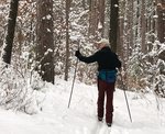
A return to North Arm Trails reminds me why they’ve always been my favorite
Maybe it’s that I’m getting older. For most of the past 15 years I had all but given up classic cross-country skiing in favor of skate skiing. It’s more exercise and it’s a …
This item is available in full to subscribers.
Attention subscribers
To continue reading, you will need to either log in to your subscriber account, or purchase a new subscription.
If you are a current print subscriber, you can set up a free website account and connect your subscription to it by clicking here.
If you are a digital subscriber with an active, online-only subscription then you already have an account here. Just reset your password if you've not yet logged in to your account on this new site.
Otherwise, click here to view your options for subscribing.
Please log in to continue |
Classic cross-country
A return to North Arm Trails reminds me why they’ve always been my favorite


Maybe it’s that I’m getting older. For most of the past 15 years I had all but given up classic cross-country skiing in favor of skate skiing. It’s more exercise and it’s a lot faster— and I like to go fast, or at least used to.
For me, the ski season didn’t really arrive until late winter, when the warming sun and milder temperatures create the crusted snow. I’ve written about my adventures skate skiing many times over the years.
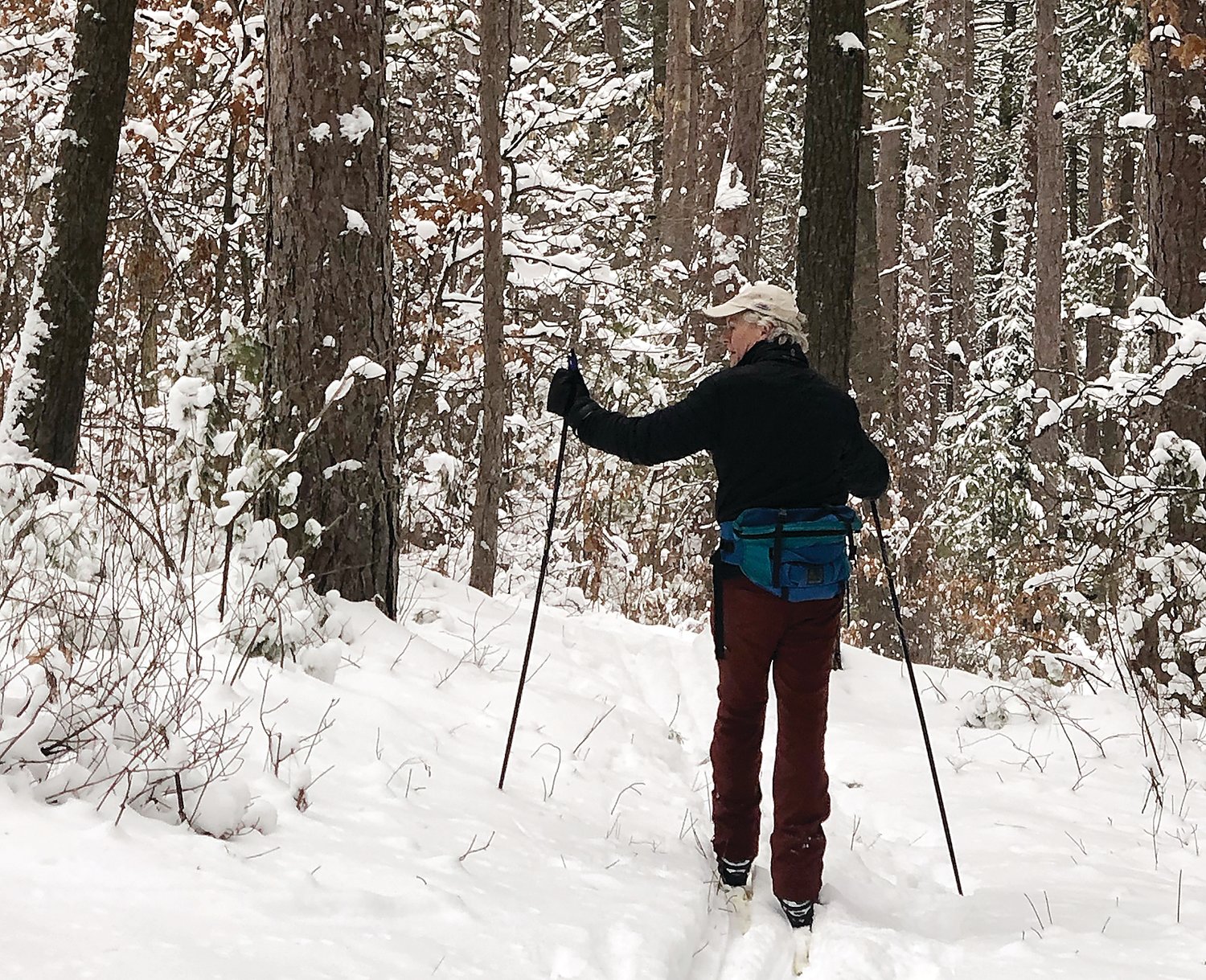
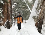
But last year, I took up classic skiing again, and it’s reminded me not only that classic skiing is fun, it’s also plenty of exercise (especially for someone who just turned 60). It’s also brought back the opportunity to ski my all-time favorite trail network, the North Arm Trails, up the Echo Trail north of Ely.
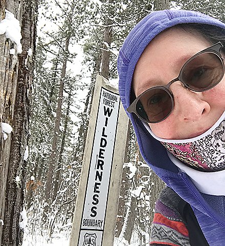
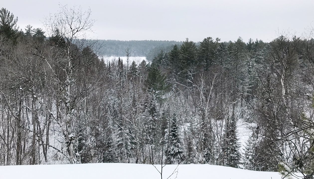
Starting from a trailhead just across the road from Camp du Nord, located on Burntside Lake’s North Arm, this network of trails extends a total of 42 kilometers and visits ten lakes, most of them within the Boundary Waters. Because the trails enter the wilderness, these are “user-groomed” trails, which are the kind I like. There are identifiable ski tracks, but not the deeply-set kind that make you feel like a train on a track. With Camp du Nord right across the road, the trails see enough use that it’s rare to have to break trail.
There are trails for every level of experience here, from flat and easy lake skiing to rugged trails justifiably rated as “most difficult.” The longest section rated most difficult is the 5.7 kilometer Ole Lake Loop, which doesn’t start until about three and a half kilometers from the trailhead. It’s my favorite section of the network, with dramatic overlooks, giant old pines, and challenging hills. When I skied it in January, it was even more challenging, since it appeared only two skiers had been on it all season. All but breaking nearly six kilometers of trail through up and down terrain certainly provided a workout.
Most parts of the network see considerably more traffic, so the conditions are usually fast and fun. The trail climbs steadily from the trailhead, but soon enough levels out, although there are few places, other than lake surfaces, that I would call flat. The forest is dominated by mature red pine, much of which was planted, either artificially or through natural regeneration, in the wake of harvesting in the early twentieth century. While much of it is within the Boundary Waters, it’s part of the 75,000-acre Burntside State Forest, which was well-managed for pine back in the day and the results of that management are evident today.
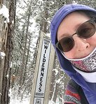
The center of the trail network provides a labyrinth of loop opportunities, virtually all rated easy or more difficult. For the more adventurous, the network offers much longer loops that visit wilderness lakes like Coxey Pond and Cummings Lake on the west, or Slim, Rice, Hook and Keneu Lake to the north. I’ve encountered slush before while skiing on some of these lakes, so be aware that’s always a possibility.
Don’t even think of trying to cover all of this network of trails in a day. I’ve skied there many times and haven’t yet taken advantage of all of its many possibilities.
Also be aware that there isn’t much cellular coverage up there, so be prepared to address any emergency issues that might occur on your own. I always bring a pack with survival stuff, some food, and water. When you’re venturing into the wilderness, don’t expect rescuers to save the day if you get in trouble.
One of the best things about the North Arm Trails is that they make great hiking trails as well, so they’re usable all year round. Just remember that, winter or summer, you should fill out a day use permit at the self-serve kiosk at the trailhead. It helps let the Forest Service know how many people are using these trails— and that provides data to support the continued maintenance of this spectacular trail system.
If you haven’t explored these trails yet, think about a visit soon, perhaps after we warm up from our weekend Arctic blast. Take the Echo Trail about ten miles north to the North Arm Road, or County Rd. 644. From there, it’s a little over two miles to the trailhead, which is located on your right, across the road from Camp Du Nord.


