Support the Timberjay by making a donation.

Flood waters near peak
But high water will remain for weeks
REGIONAL- The last thing the flood-weary people of Kabetogama and Crane Lake wanted to see this past week was more rain, but Sunday and Monday thunderstorms over the Rainy River Basin may have been …
This item is available in full to subscribers.
Attention subscribers
To continue reading, you will need to either log in to your subscriber account, or purchase a new subscription.
If you are a current print subscriber, you can set up a free website account and connect your subscription to it by clicking here.
If you are a digital subscriber with an active, online-only subscription then you already have an account here. Just reset your password if you've not yet logged in to your account on this new site.
Otherwise, click here to view your options for subscribing.
Please log in to continue |
Flood waters near peak
But high water will remain for weeks
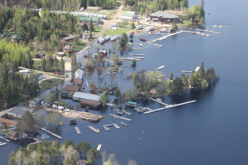
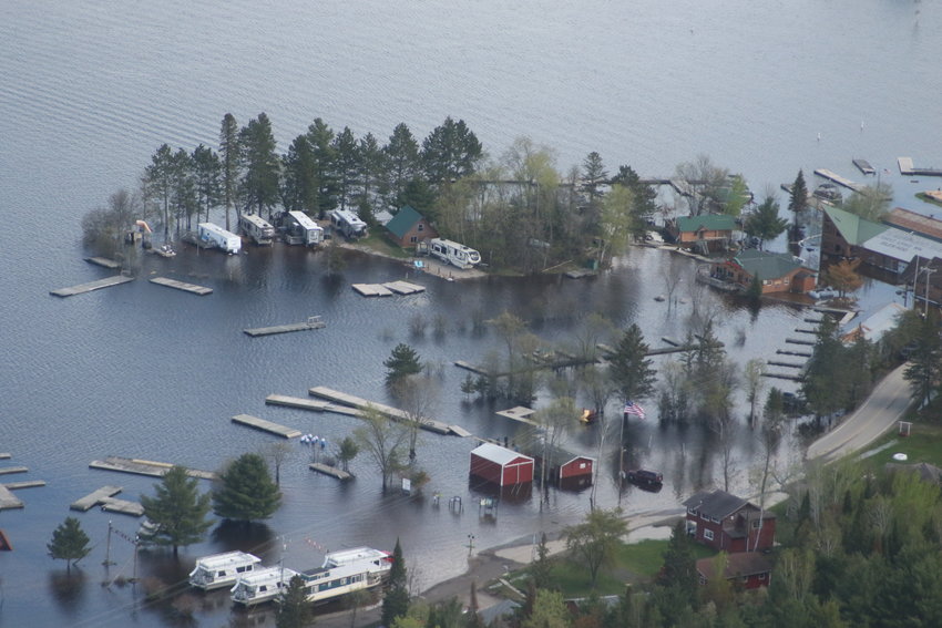
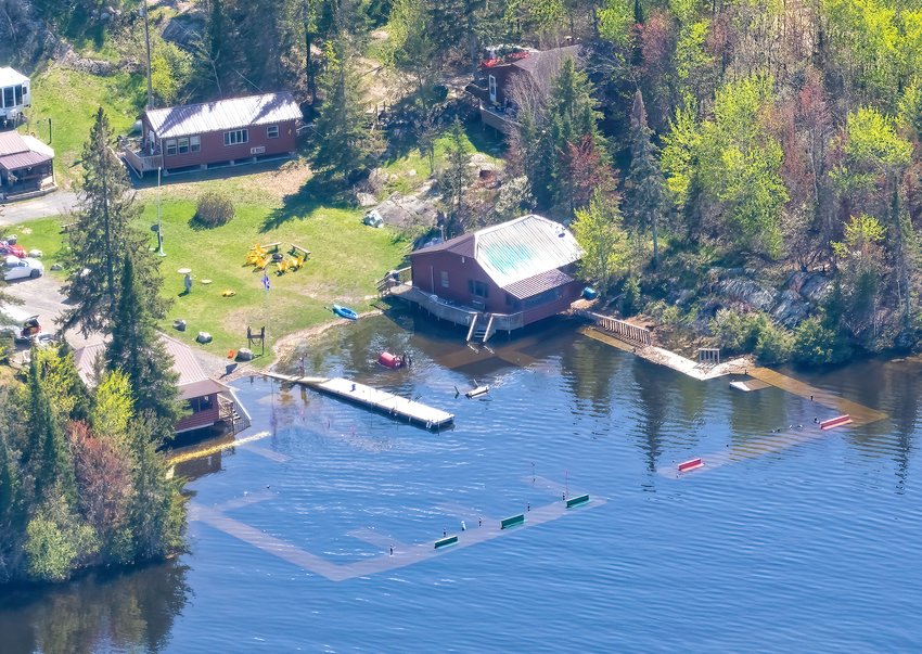
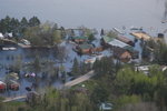
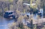
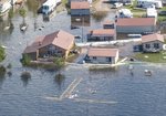
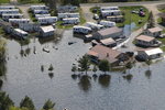
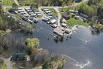
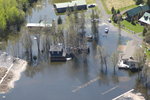
REGIONAL- The last thing the flood-weary people of Kabetogama and Crane Lake wanted to see this past week was more rain, but Sunday and Monday thunderstorms over the Rainy River Basin may have been Mother Nature’s final soggy salvo in a month-long record-breaking surge.
A week before Memorial Day, forecasters were worried the holiday weekend would usher in a week of above-average precipitation. Instead, the system blew through in two days, dropping an average of close to two inches across the basin with locally heavier showers and damaging high winds in some areas, but by Tuesday, Duluth National Weather Service (NWS) Meteorologist Joe Moore had a decidedly sunnier outlook to provide.
“This was pretty much the last chance for notable precipitation in the next six to ten days,” Moore told the Timberjay. “It looks like a great dry weather pattern for northern Minnesota, which is great news for the flooding.”
Moore said that the rain would create a “little bump” in stream flows as the moisture works its way through the basin, but that the recent trend of decreasing inflows into the basin would continue.
“It’s not like we’re going to see a significant push anything like what’s been going on,” he said.
The drier weather pattern also means that chances for setting all-time highs have decreased.
“At this point it looks like we’re probably going to fall short of that 1916 level for Kabetogama and Namakan, which is certainly good news,” Moore said. That 1916 record pre-dates formalized controls on water levels in the region and also occurred before there was much residential or commercial development, like resorts, on the lakes affected by the flooding.
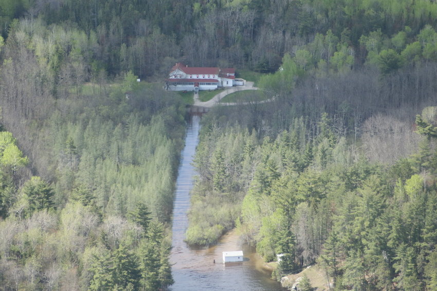
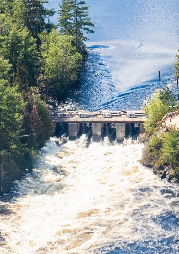
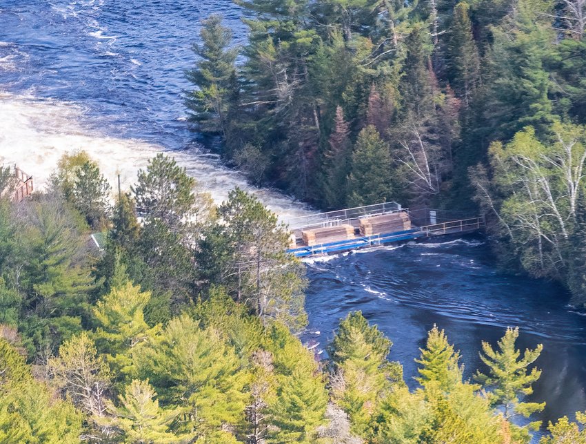
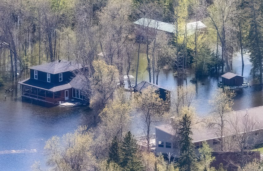
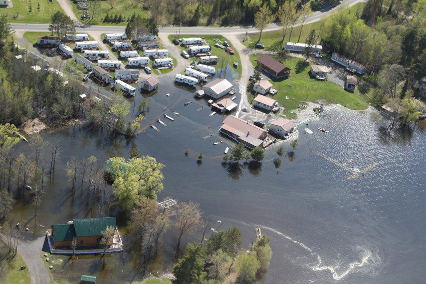
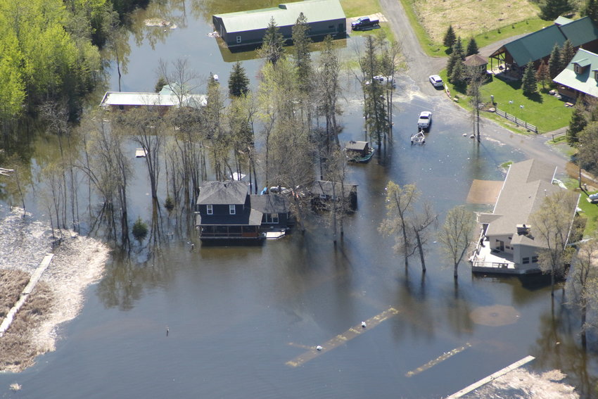
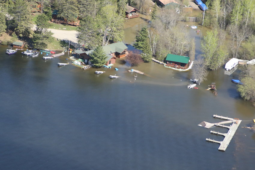
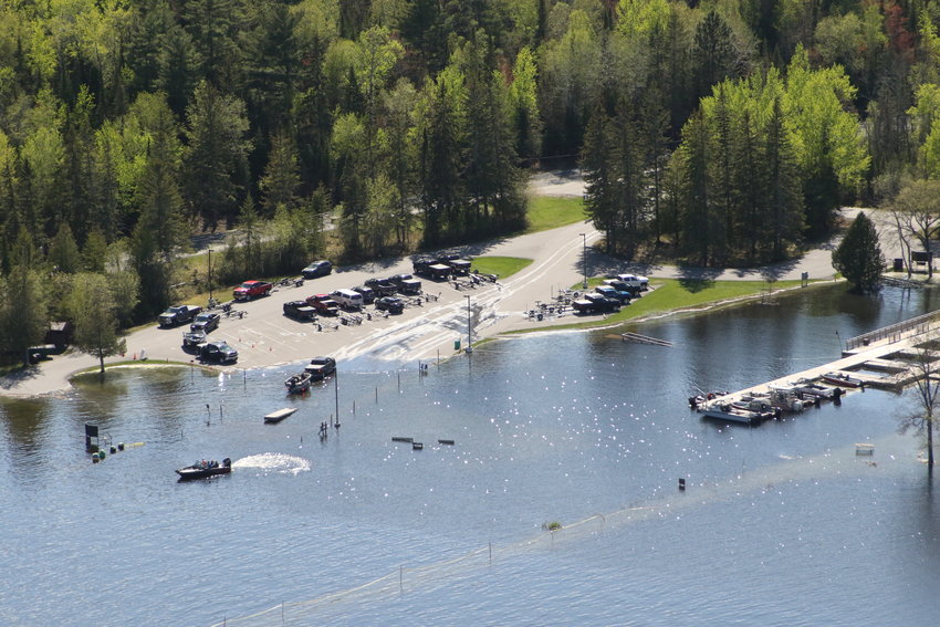
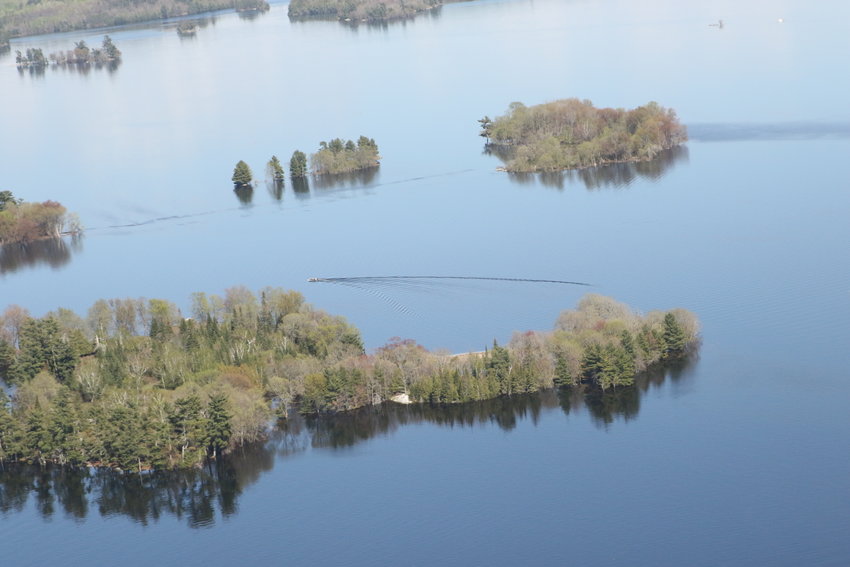
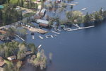
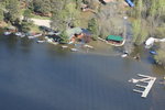
This year’s flooding has already surpassed anything experienced in the past century, including the previous high water mark, set in 1950, and while the rate of rise has slackened, more water is still flowing into the basin than is flowing out. Monday’s NWS projection was for Namakan Lake to rise another one to two inches, peaking on June 5 and then beginning to fall. Rainy Lake is projected to rise eight to 11 inches during the same period, but will continue rising into the following week, regardless of precipitation.
“Areas currently experiencing flooding and having to perform mitigation measures will likely continue to deal with these issues for the foreseeable future,” the NWS Monday update said. “Lake levels will likely continue to rise into June and continue to cause extensive damage to docks and shoreline property.”
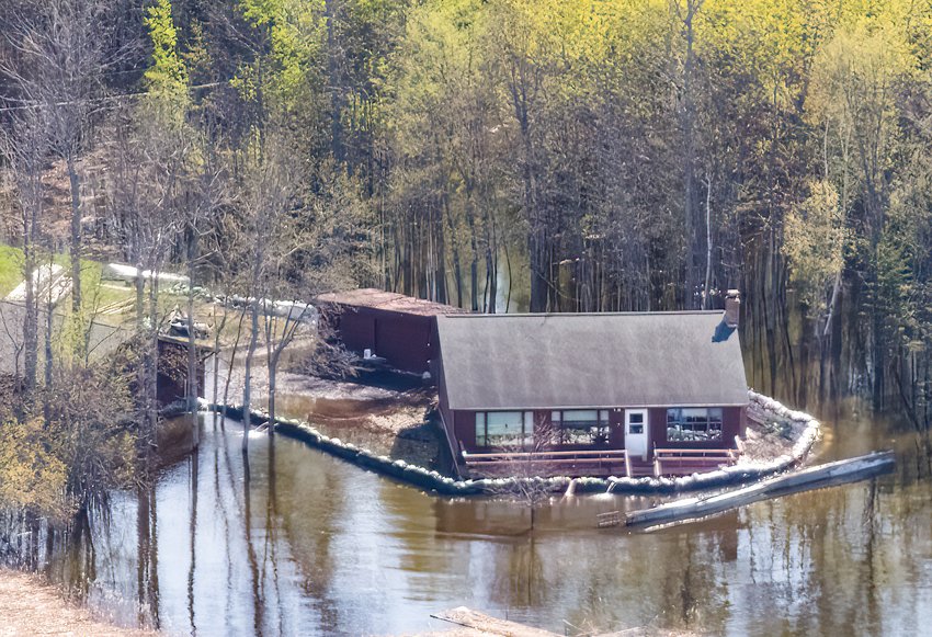
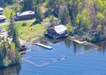
Activity continued apace throughout the region to try to blunt the impact of the flooding. After a short pause over the weekend, volunteers in Crane Lake were back in full force on Monday at the sandbag operation at Anderson’s.
“Thank you everyone from cabin owners, locals in town and outside our community, guests staying at resorts, staff and local businesses who helped sandbag today and from the beginning of this horrible record-breaking flooding,” said Beth Bak in a social media post. “We did approximately 1,890 bags today for a total of 11,390 bags. Donations coming in from people who can’t make it, it’s been amazing!”
But as the sandbag barriers rise around resorts and homes, they’re in danger of toppling after being pounded by waves generated not by nature, but by boats.
No-wake zones have been established on all of the lakes in the Rainy River Basin, requiring that boaters within 300 feet of shore throttle down to eliminate damaging waves. Apparently, many watercraft aren’t heeding the warning.
“Folks, we’ve already had reports of sandbag walls falling from boat wakes,” the Kabetogama Fire Department posted on its social media page on Monday. “Resorts, please make sure your rental customers know how dire it is to keep wakes at a minimum of 300 feet away from shorelines. Also, these conditions are extremely dangerous for boaters. Debris can float above and below the surface of the water. Slow down – no wake.”
“Humans appear to present the most immediate threat to the sandbag barriers, as gusty winds over the next few days should have minimal impact,” Moore said.
“Talking to the people affected by the flooding, the south shore of Kab and south shore of Rainy, they’re really sensitive to north winds and east winds,” Moore said. “Most of the stronger winds the next few days are out of the west, so the wave direction should be away from people’s properties, at least through the next five to seven days.”
Moore also reinforced the call for boaters to observe the no-wake zones.
“We don’t want those sandbagged areas to be breached,” he said. “It’s so many hours of backbreaking work – their whole lives are at risk. It’s really critical that people follow these instructions.”
And while a turning point is in sight, flooding conditions won’t be going away any time soon.
“Rainy Lake will probably take on an order of six to eight weeks from the peak to get back down,” Moore said. “That will be dependent on rainfall. If we do see a drier period that drop could happen faster.”