Support the Timberjay by making a donation.

Winter green
A late December hike in a snowless BWCAW was disorienting at times
Late December in the Boundary Waters is supposed to be a season laden in white. But in an unprecedented year it was the deep greens that stood out during a hike along the Norway Trail, north of Trout …
This item is available in full to subscribers.
Attention subscribers
To continue reading, you will need to either log in to your subscriber account, below, or purchase a new subscription.
Please log in to continue |
Winter green
A late December hike in a snowless BWCAW was disorienting at times

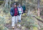
Late December in the Boundary Waters is supposed to be a season laden in white. But in an unprecedented year it was the deep greens that stood out during a hike along the Norway Trail, north of Trout Lake.
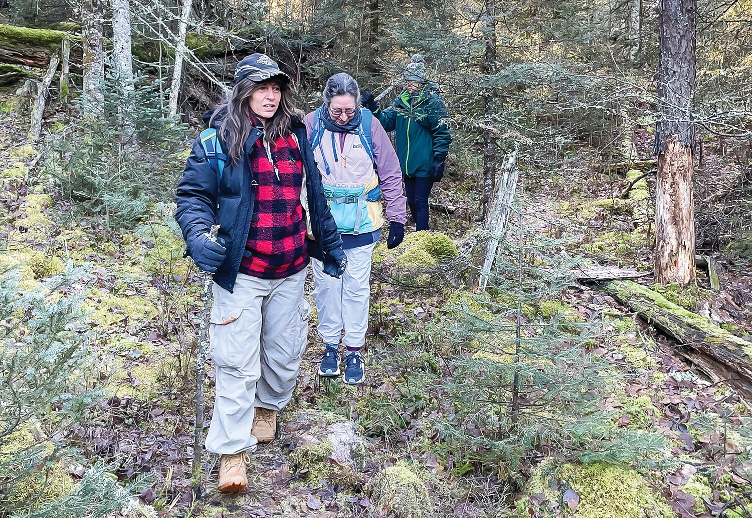
After more than a week of rain, fog, drizzle, and above freezing temperatures, what little snow had fallen earlier in the month had disappeared. The ice had grown iffy for skating, so four of us, along with two dogs, headed to the west end of the Echo Trail to check out the late-December wilderness. A hike through snowless terrain on December 27. In the Boundary Waters. It seemed unimaginable, which was part of the appeal.
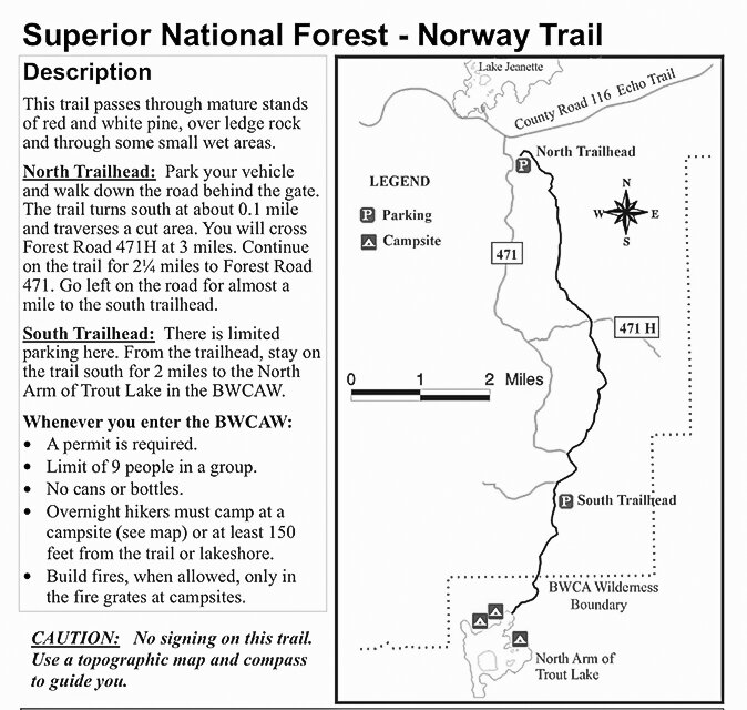
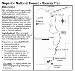
I hadn’t hiked the Norway Trail before and like most Boundary Waters trails it took a bit of hunting to find the trailheads. There’s a north trailhead, which we opted against because it was 16 miles out and back, which was a bit more than we were up for, particularly given the limited daylight this time of year. So, we headed toward the south trailhead, which was supposed to be four miles round-trip. It wasn’t terribly ambitious, I know, but by the time we factored in the wrong turns and detours, it turned into a nine-mile jaunt.
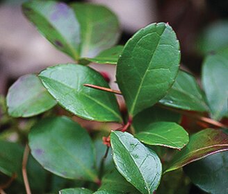
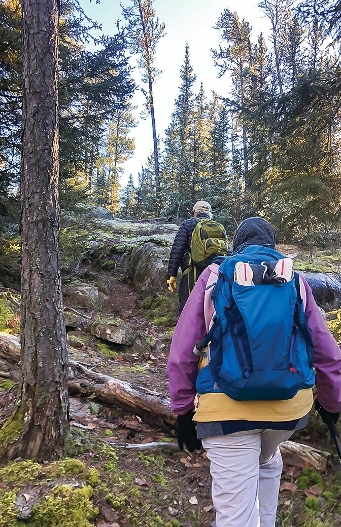
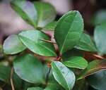
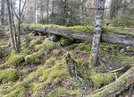
Our first wrong turn came before we even made it to the trailhead. Somewhere along the road, about the area we were expecting, we found a sign that simply said “Trail,” and pointed off into the woods. There was a slight pull-off and we figured this was what the Forest Service was calling a trailhead. We donned our backpacks, which were lightly loaded with a few survival items, dry socks, water, and snacks, and headed toward the trail. The woods were damp but not wet and the mosses were practically glowing after days of what could only be described as mossy weather. “It reminds me of the Pacific Northwest,” my sister commented as we passed through one particularly green stretch of blackjack forest. “Blackjack” is the term to describe the dominant species mix in the boreal forest— black spruce and jack pine, a type that extends from far northeastern Minnesota to the tree line. Here, on the southern edge of the boreal forest, the blackjack type is less common than in the heart of the taiga and the forest includes species like red and white pine and red maple, which fade out as you head north.
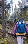
The trail was rugged at times, and not particularly evident at one point as we negotiated our way through a beaver meadow complete with flowing water from the recent rains. It was a typical wilderness trail in other words.
We had hiked about two miles along the trail when the sun had peaked out at us just enough to leave me confused. We had assumed the trail was taking us to the south, where it was supposed to terminate at the north arm of Trout Lake, but I kept noticing my shadow ahead of me. I pulled out my phone’s GPS app and immediately realized we had been heading north and would need to return the way we had come if we wanted to get to Trout Lake. It could have been deflating but the weather was mild and the clouds were parting into a beautifully clear day so we headed back to the car, had a snack, and then started walking down the road looking for the actual trailhead. A half mile later, we found a sign that indicated it was Entry Point #10 to the Boundary Waters, next to which we found a path heading south. We assumed this was the trailhead and took the path, which proved a surprisingly level and easy trek most of the way, with a few interludes through some interesting rock outcrops. It turned out we were on the right path this time and after about an hour, we arrived at the lake. I had expected a typical Trout Lake shoreline, a glorious pine-covered outcrop leading gently to the water, but it turns out it was low and swampy. We found a slight rise under a stubby white pine and sat down for a midday meal of hard-boiled eggs (thanks to our chickens!) and energy bars, while listening to the silence of the wilderness and enjoying the sunshine glistening across the mottled ice. It was after 2:30 p.m. by the time we started back and we knew that we’d be flirting with darkness if we didn’t make our way quickly.
Along the way we had kicked up a few grouse, but on the way back bigger game crossed our path. About halfway back to the car, our dogs went on high alert, telegraphing that something large was nearby. It was the very large and very fresh moose tracks, which hadn’t been there during our first pass through, that identified the source of the dogs’ alarm even though we never got a glimpse of the animal itself. We didn’t linger long in hopes of spotting it given that our daylight was ebbing.
The sun was nearly set by the time we made it back to the car, and we were all happy to be off our feet for a while. It had been a great way to spend a day, even though it was somewhat disorienting. The forest had the look and feel of late October, even though the calendar told a different story. Would we ever again be able to hike a snowless Boundary Waters on Dec. 27. I’d like to think not, but in a world where the climate is increasingly out of whack, I wouldn’t bet against it.


